Congratulations to PhD student Clément Colin (BL Research team), and his two colleagues Diego Alvarez-Vinasco and Corentin Gautier, PhD students at Liris (Laboratoire d’informatique en image et système d’information du CNRS), for winning the 1st prize !
The referent event on digital geography
GeoDataDays is the French referent and independent event on digital geography. It has been organized by Afigéo and DécryptaGéo, in partnership with the French Ministry of Ecological Transition and Territorial Cohesion, the CNIG, Connect by CNES, ENEDIS, the GIP ATGERI and some others partners. It allows to detect nuggets in the field of geomatics: applications to better understand territory (geography, past or future evolution); new digital approaches; simulations; datavisualization; dynamic mapping, etc.
Urban Data Services and Visualisation Platform
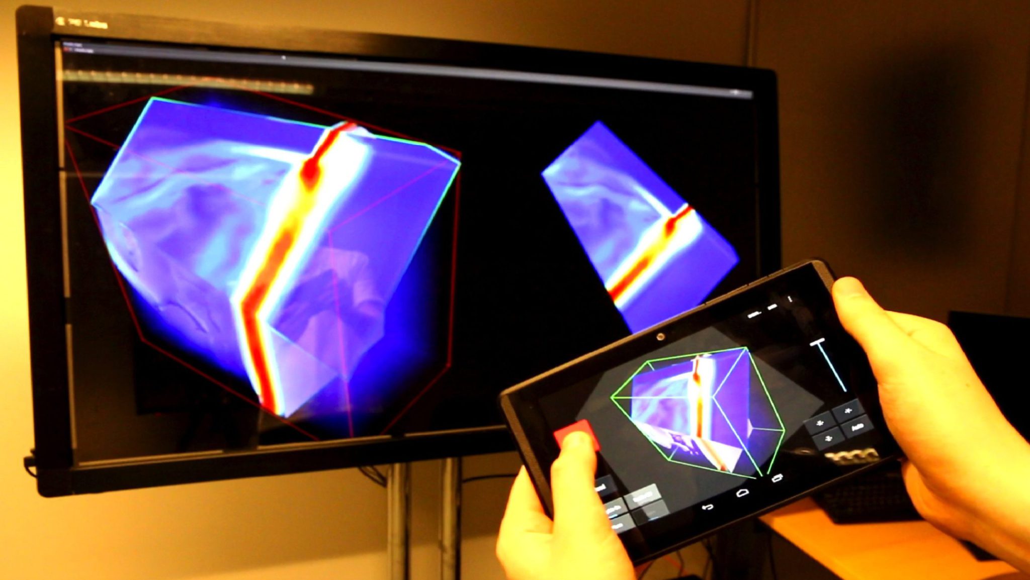
Their scientific work rewarded focuses on UD-SV (Urban Data Services and Visualisation) platform: a set of components and software tools dedicated to experimentation, exchange and knowledge sharing to explore multidimensional urban data. This platform provides solutions to process, store and visualize scalable urban data, through multimedia items, 2D/3D geometries, and knowledge graphs. A great prize offering the upcoming article publication in the renowned quarterly magazine Mappemonde!
These advances also feed the BL.Visualize project conducted at BL Research. Thus, our BL.Visualize experts are adapting this UD SV technology to enrich it to the BIM/CIM methods and equipment management, and to help decision making through multi-scale visualization.