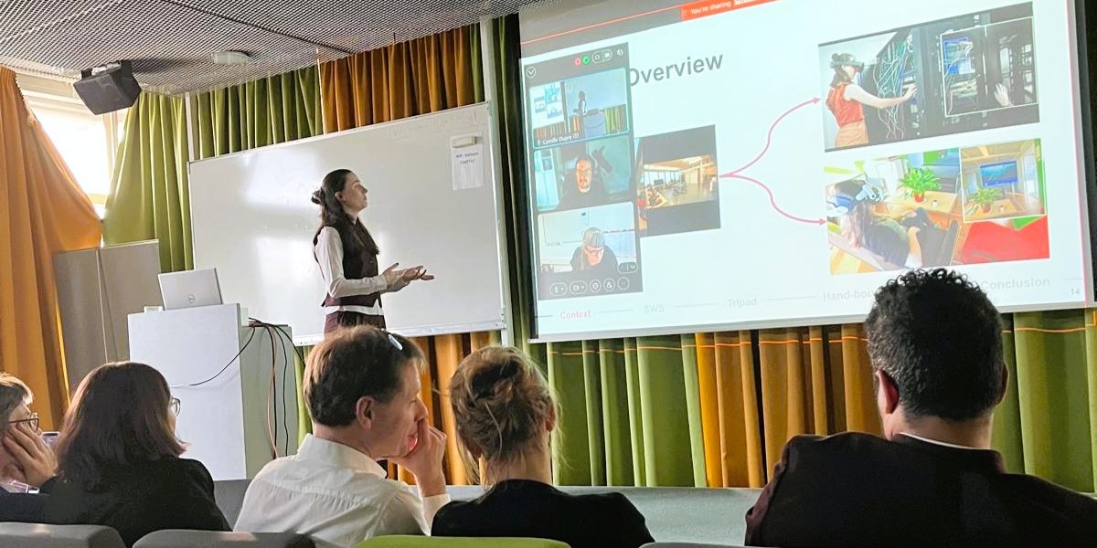
BL-VIZ4D is a research project led by Berger-Levrault, dedicated to the visualization, synchronization, and interaction with digital twins applied to maintenance.
Stemming from thesis work conducted in partnership with the LIRIS laboratory (Laboratory of Image Informatics and Information Systems), BL-VIZ4D explores the scientific and technological foundations of a multi-scale 3D viewer capable of aggregating heterogeneous geospatial data—attribute, 2D, and 3D—and linking it to CMMS business processes.
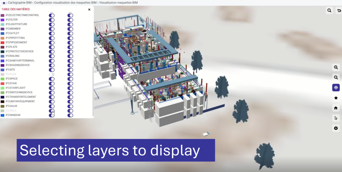
The viewer allows for the integration and cross-referencing of data:
- GIS: 2D maps from ArcGIS (ESRI©) or open-source mapping engines, for the management of linear assets (water and sewer networks, roadways, signage, railways) or point assets (street lighting, street furniture, green spaces, etc.).
- CAD: 2D drawings in DWG format (AutoCAD©, Archicad©, etc.), used for buildings and major infrastructure (hospitals, administrative buildings, airports, ports, engineering structures, etc.).
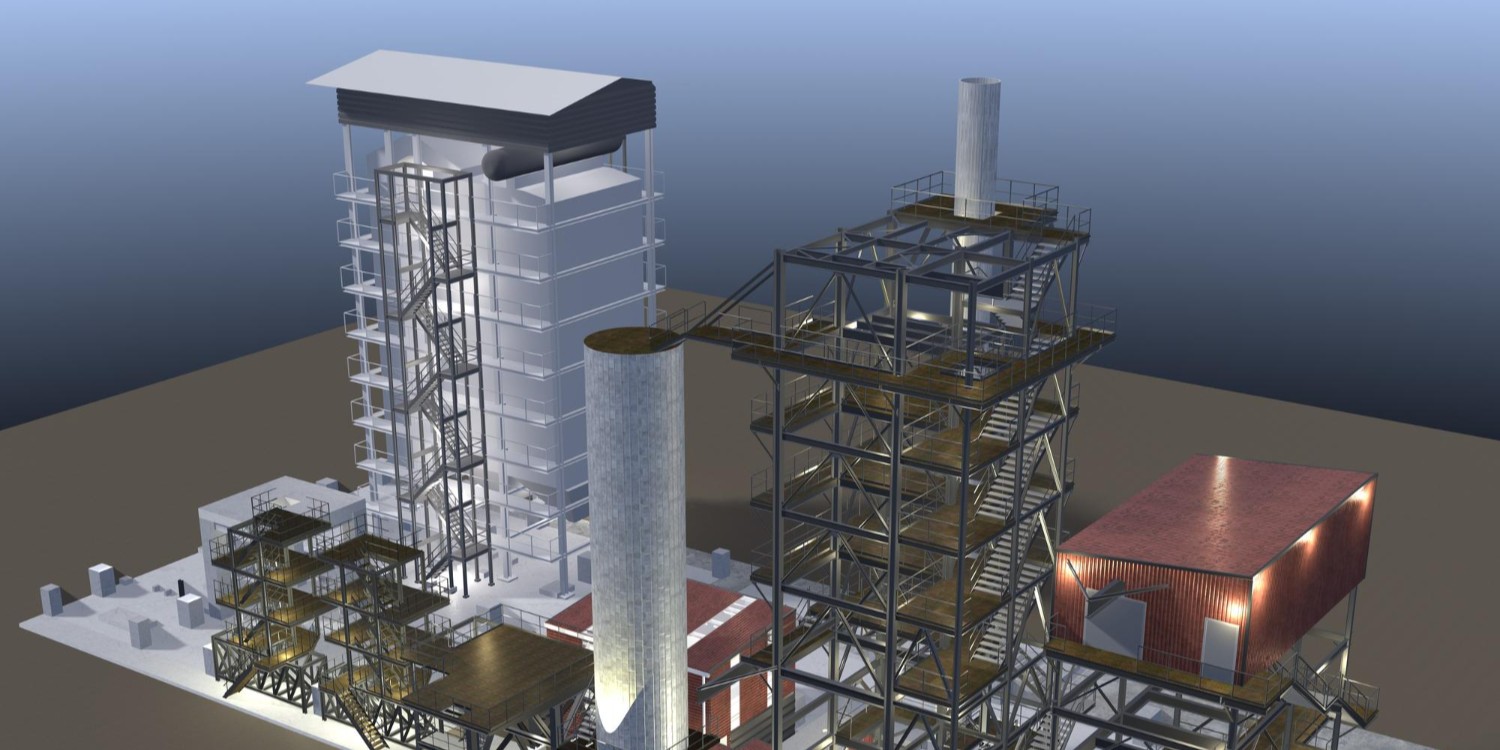
- BIM & CIM: 3D digital models in IFC format, providing detailed descriptions of the structure and components of the facilities.
BL-VIZ4D serves as a unified interface between the digital twin of equipment and business users. It not only allows users to explore and visualize data across the territory, but also to interact directly with it in an operational context. One of the project’s major contributions lies in its integration with our equipment maintenance and management software CARL Source: by linking geospatial objects with maintenance data, it becomes possible to perform management operations directly from the digital twin of the equipment in BL-Viz.
The technological challenges at the heart of BL-VIZ4D
The BL-VIZ4D project lies at the intersection of several scientific fields: computer graphics, geographic information systems, data interoperability, and maintenance systems engineering. Three major challenges shape the research efforts.
1. Data heterogeneity
The data being processed differs in terms of:
- their formats (IFC, DWG, shapefiles, 3DTiles…),
- their levels of detail (LOD),
- their coordinate systems,
- their semantics (BIM object vs. GIS feature vs. CMMS asset),
- their temporal dynamics (IoT data, maintenance histories).
A key challenge is the semantic and geometric alignment of these sources to produce a coherent and navigable digital twin.
2. Interoperability
Interoperability is not limited to format compatibility. It involves:
- the correspondence between technical objects and business assets in the CMMS,
- bidirectional synchronization between visualization and the information system,
- management of data evolution over time (4D dimension).
BL-VIZ4D follows an Open BIM approach, favoring the use of open formats (IFC, 3D Tiles) to ensure longevity and independence from modeling tools.
3D Visualization on the Web
Visualizing large-scale models and spatial data presents challenges in:
- managing large volumes of data,
- 3D streaming and tiling,
- real-time rendering in a browser,
- adapting to users’ hardware limitations.
The project explores strategies for geometric simplification, level-of-detail prioritization, and rendering pipeline optimization to ensure a smooth and usable experience in a business context.
A modern architecture based on open source
BL-VIZ4D is built on an open and modular architecture:
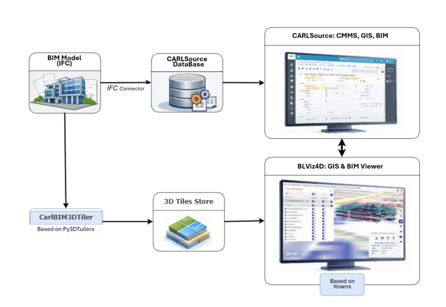
In line with the openBIM approach, BLViz4D relies on open-source tools and data formats:
- iTowns: a web-based 3D visualization engine that supports multi-scale management (from the globe to the building) and the integration of geospatial data.
- Py3dtilers: a tool for converting and generating 3D tiles, facilitating the progressive streaming of large models.
- Open formats:
- IFC for BIM,
- 3D Tiles for web distribution,
- GIS standards (WFS, WMS) for spatial data.
A viewer for maintenance
BL-VIZ4D goes beyond simple 3D visualization. It is part of an approach to maintenance enhanced by the digital twin. The viewer thus becomes an operational gateway to maintenance, rather than merely a visualization tool.
For asset managers, the value lies in the ability to have a unified, multi-scale view of facilities. Whether at the regional, site, or building level, they can contextualize maintenance data within its actual spatial environment. Cross-referencing information from CMMS and digital twins enables the anticipation of interventions and the assessment of the spatial and functional impact of decisions made. 3D visualization then becomes a management tool, facilitating the prioritization of actions and the understanding of dependencies between systems. For field technicians, the viewer serves as a diagnostic support tool. Understanding networks—whether pipelines, cables, or underground structures—is facilitated by a coherent spatial representation linking 2D plans, GIS data, and 3D models.
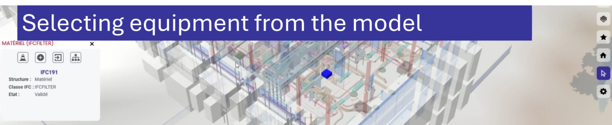
Integration with CARL Source enhances this business-oriented aspect. From an object visualized in the model, the user can access its history, view its technical specifications, or initiate a maintenance operation. The digital twin is no longer merely a faithful representation of the existing infrastructure but becomes an active entry point into management processes.
Future Work: Toward Dynamic Digital Twins
The scope of BL-VIZ4D now extends beyond the simple integration of heterogeneous data into a web-based 3D environment. The challenge is now to evolve the viewer into a true dynamic digital twin, capable not only of representing a state at a given moment but also of guiding users in understanding and monitoring the evolution of their equipment.
A key initial project involves simplifying navigation and interaction within the 3D environment. One of the major barriers to the adoption of visualization tools lies in their perceived complexity. Future work will aim to offer navigation modes tailored to specific industries, guided tours based on usage scenarios, and mechanisms for automatically highlighting relevant equipment. The goal is to reduce cognitive load, facilitate the understanding of complex systems, and establish 3D as a natural decision-making tool.
At the same time, special attention will be paid to the temporal and evolutionary nature of infrastructure. Maintenance is a long-term process: installation, operation, successive interventions, upgrades, and replacement. Added to this are the continuous data streams from the IoT, which provide near-real-time insights into the operational status of assets. Future work will seek to fully integrate this 4D dimension into the viewer by exploring different solutions for representing the evolution of equipment. This will involve studying mechanisms for temporal navigation, comparing successive states, and visualizing life cycles, while avoiding visual overload.
The scientific challenge lies in integrating real-time data, consolidated historical data, and interactive 3D web-based visualization. The goal is to enable users to understand not only where a piece of equipment is located and how it is structured, but also how it evolves over time. Through this work, BL-VIZ4D aims to transform the viewer into a true tool for dynamically interpreting heritage, supporting more proactive, contextualized, and effective maintenance.