Bim World 2026 (Paris – France)
Bim World 2026 (Paris – France) Read More »
BL-VIZ4D is a research project led by Berger-Levrault, dedicated to the visualization, synchronization, and interaction with digital twins applied to maintenance. Stemming from thesis work conducted in partnership with the LIRIS laboratory (Laboratory of Image Informatics and Information Systems), BL-VIZ4D explores the scientific and technological foundations of a multi-scale 3D viewer capable of aggregating heterogeneous
BL-Viz4D: A Digital Twin viewer for Maintenance Read More »
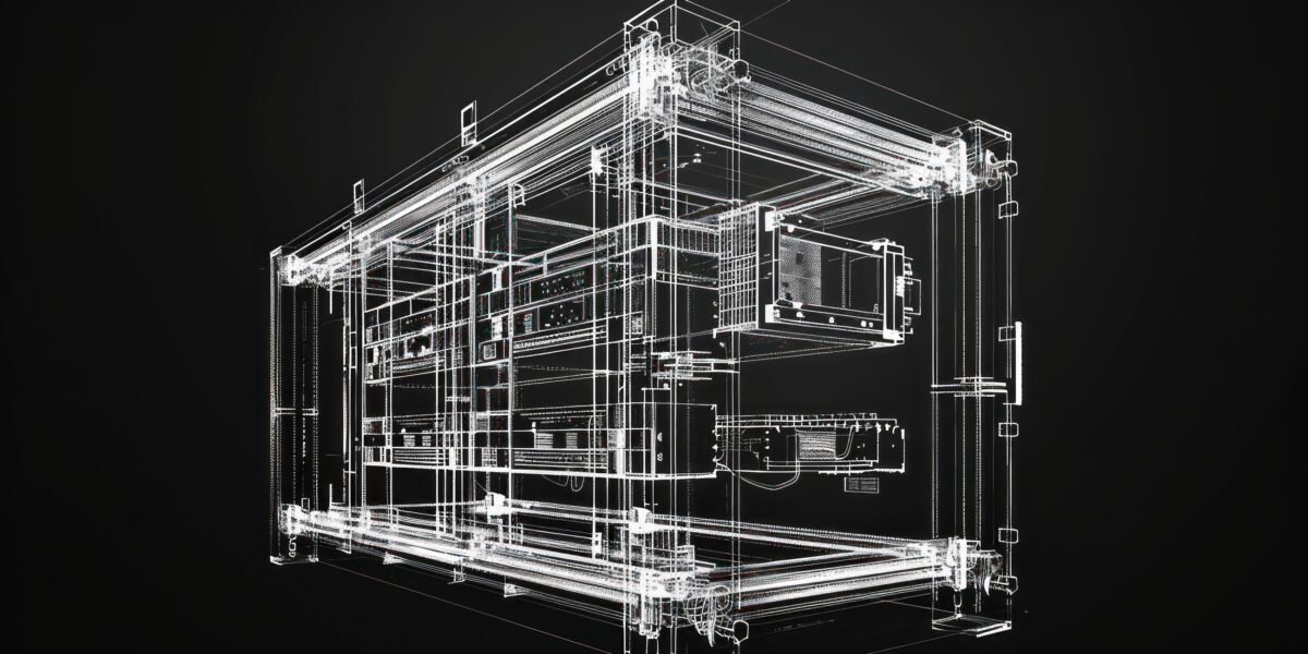
The integration of BIM data into CMMS for asset management and maintenance is becoming increasingly widespread and accessible. Among the standardized data models used in the built asset industry, IFC (Information For Construction) remains the most widely adopted open format within the BIM domain. It facilitates the creation of digital twins of buildings, combining semantic
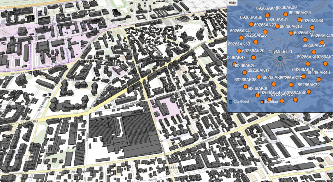
Being able to create unified views of all kinds of geospatial data (2D, 3D, and semantic data) from the BIM and CIM domains is essential for decision-making in urban development projects and in a CMMS context. Our objective is to provide users with integrated and navigable views of available representation of urban objects through a
Integrating 3D geospatial data Read More »
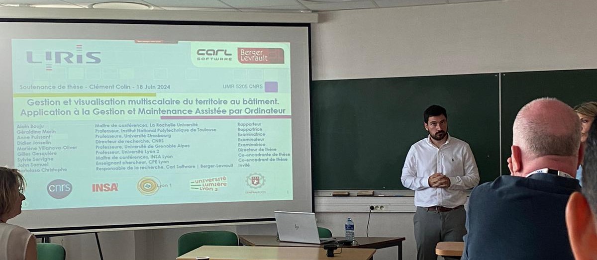
Tuesday 18th of June at 10h a.m. Paris time, Clément Colin, Ph.D. Candidate has defended his thesis named “Multi-scale geospatial data management and visualisation applied for CMMS”. His thesis defense took place at the conference room of the Faculty “IUT Lumière Lyon 2” in Villeurbanne, France. Take a look at the summary below : Summary
Find the first part of this article by following this link Navigation in the context of a CMMS asset using geometric and semantic data Our goal is to provide the user contextual views of an asset, thus to allow him to visualize the asset at different scale or using the many asset representations to answer
Equipment 3D visualization in a CMMS application-2nd part Read More »
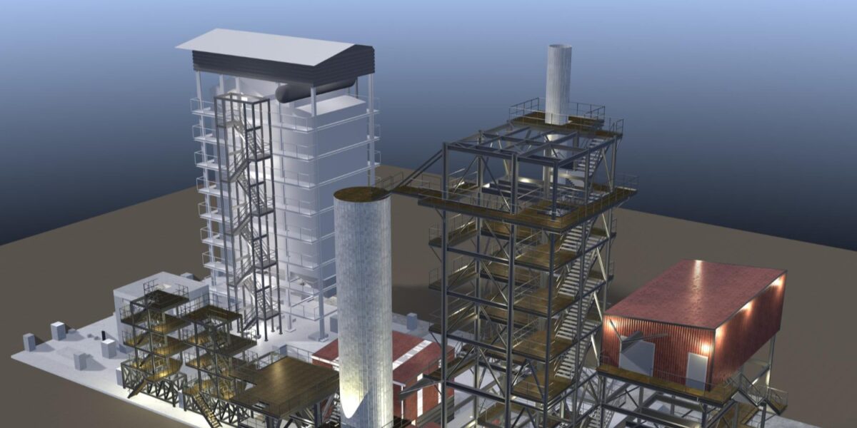
Computer-aided maintenance systems aim at assisting administration and maintenance agents in their missions of assets maintenance (building, network, air conditioning, faucets, etc). Assets may have different representations in different geospatial data sources (2D or 3D) that can help to have a better understanding of them by providing new information. Though, using those data often leads
Equipment 3D visualization in a CMMS application-1st part Read More »